RussiansInUSA editorial team · Facts checked November 11, 2026 · Official site
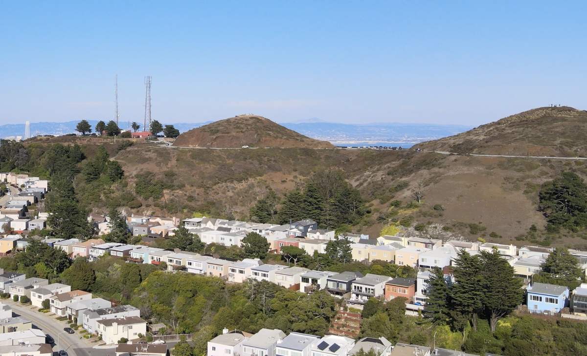
Twin Peaks in San Francisco is a pair of grassy hills with a city park on their slopes, at 501 Twin Peaks Boulevard. At 922 feet, San Francisco Recreation and Parks says, it is second in height only to Mount Davidson. People come up for the 360-degree view over the city and the bay. The park is open from 5 a.m. to midnight, and its page lists no entry fee. For the city as a whole, see our San Francisco page.
History of Twin Peaks
According to the parks department, early Spanish settlers called the two summits Los Pechos de la Choca, "the Breasts of the Maiden."
The Twin Peaks Tunnel, a Muni rail tunnel, carries the hills' name. SFMTA says it was finished by mid-1917, and in 1918 the K Ingleside streetcar ran through its West Portal. The East Portal opened onto Market Street at Castro Street, and the tunnel gave streetcars access to the southern and western parts of the city.
Today Twin Peaks is a 64-acre park designated as a Natural Area. The slopes hold grassland and coastal scrub, which the parks department compares to the Marin Headlands across the Golden Gate.
In recent years part of the hilltop has been handed to people on foot. Twin Peaks Boulevard loops around the summits in a figure eight. The parks department dates a pilot road closure on the boulevard to 2015. In April 2016 SFMTA began testing a layout with no cars on the east side of the loop, and in April 2020 the SFMTA Board made that closure permanent.
A trail improvement project began in 2013, to deal with failing steps, a shortage of signage and redundant informal trails. It adds new steps, retaining walls, fencing to protect sensitive habitat and new wayfinding signs. The project also turns part of Twin Peaks Boulevard into a full-time pedestrian space, the Twin Peaks Promenade: two parallel paths, one smooth and accessible for strollers, wheelchairs and bikes and one natural-surface trail for walking and jogging, with seating and overlooks.
What to see at Twin Peaks
The view from the summits. A 0.7-mile trail network climbs both peaks, each with a 360-degree view. The parks department says the views from the summits surpass those at the north peak overlook.
Christmas Tree Viewing Area. The overlook the parks department calls the Christmas Tree Viewing Area has a small parking lot.
The Mission blue butterfly. Twin Peaks is home to the Mission blue, a federally endangered butterfly that feeds and lays its eggs on three native lupine species. In 2009, 22 pregnant females were released here, and Twin Peaks is now the only place in the city where the butterfly survives. That is why the lupine patches are fenced off.
Other wildlife. Look for white-crowned sparrows, brush rabbits and coyotes. Among the plants the parks department lists coyote brush, lizard tail, pearly everlasting and lupine.
Trails beyond the top. More trails run along the southern and eastern slopes. The parks department suggests continuing down Twin Peaks Boulevard toward Portola Drive into Glen Canyon Park, a 1.2-mile hike. The promenade is part of both the Bay Area Ridge Trail and the Creeks to Peaks Trail.
Sutro Tower. The 977-foot steel broadcast tower stands on neighboring Mount Sutro. Its owner says the first stations went on the air on July 4, 1973.
How to get to Twin Peaks
The Muni 37 Corbett bus comes closest to the summits. It runs between Masonic Avenue and Haight Street and a terminal at Parkridge Drive and Burnett Avenue, with stops on Crestline Drive and at Market and Castro streets.
| Option | Details |
|---|---|
| Muni 37 Corbett | Stops on Crestline Drive. Weekdays 6 a.m. to 10 p.m., weekends 9 a.m. to 10 p.m. |
| Muni 48 Quintara/24th Street | Stops on Portola Drive, below the hills; walk up from there |
| By car | Twin Peaks Boulevard. Plenty of street parking off Crestline Drive and a small lot at the Christmas Tree Viewing Area |
| On foot | From Glen Canyon Park up Twin Peaks Boulevard |
Which boulevard gates are open to cars is posted on the Recreation and Parks Twin Peaks page. Check the 37 Corbett route page on SFMTA for the schedule.
Twin Peaks hours and entry
| Item | Details |
|---|---|
| Park hours | Daily, 5 a.m. to midnight |
| Entry | No fee listed on the park's site |
| Parking | Street parking off Crestline Drive, small lot at the Christmas Tree Viewing Area |
| Address | 501 Twin Peaks Boulevard, San Francisco, CA 94114 |
Hours and visitor information checked November 11, 2026 on sfrecpark.org.
Tips before you go
- Bring a jacket: the parks department warns of strong winds on the summits.
- Stay on the established trails to avoid poison oak and to keep the slopes from eroding.
- Do not leave valuables unattended, and stay aware of your surroundings.
- The last 37 bus leaves around 10 p.m., though the park stays open until midnight.
- Report maintenance problems in the park to the city's 311 service.
More sights are on our San Francisco places page.
Questions people ask
Is Twin Peaks free to visit?
The San Francisco Recreation and Parks page for this 64-acre city park lists no entry fee. It is open daily from 5 a.m. to midnight. The lot at the Christmas Tree Viewing Area is small, but the parks department says street parking off Crestline Drive is widely available.
What bus goes to Twin Peaks?
The Muni 37 Corbett bus comes closest, stopping on Crestline Drive and at Market and Castro streets. It runs from 6 a.m. to 10 p.m. on weekdays and from 9 a.m. to 10 p.m. on weekends. The 48 bus stops lower down, on Portola Drive. Check the schedule on SFMTA before you go.
Can you walk up Twin Peaks?
Yes. A 0.7-mile trail network climbs both summits, and more trails follow the southern and eastern slopes. From Glen Canyon Park below, a 1.2-mile route runs via Portola Drive and Twin Peaks Boulevard. Stay on marked trails, since poison oak grows on the slopes.
How high is Twin Peaks?
Twin Peaks rises to 922 feet, about 281 meters. San Francisco Recreation and Parks says only Mount Davidson is higher in the city. The nearby Sutro Tower, a 977-foot broadcast mast, stands on neighboring Mount Sutro.
Places on the map
Sources
- Twin Peaks, San Francisco Recreation and Parks
- Twin Peaks Trail, San Francisco Recreation and Parks
- Twin Peaks Trails Improvement and Promenade Project, San Francisco Recreation and Parks
- 37 Corbett, SFMTA
- 48 Quintara/24th Street, SFMTA
- Party like it's 1918: Twin Peaks Tunnel turns 100, SFMTA
- Tower History, Sutro Tower